Works with any digital camera.
‘Geotagging’ refers to the addition of GPS location data to your digital images. While images taken on a cellphone are automatically geotagged, most digital cameras do not provide this facility. Even most of the latest digital cameras are deficient in not providing built-in geotagging in the interest of saving on battery drain, and saving on cost, as no GPS receiver is required. Some manufacturers, like Nikon, will sell you a separate GPS unit conceptually similar to the one linked immediately below.
I last addressed geotagging in 2012 when I attached a GPS receiver to my Nikon D700 and recorded GPS data on a separate data logger, a small storage device carried in the pocket.
I continue to regard geotagging as an important tool when it comes to retrieving old images, a tremendous aid to putting them in a specific time and place.
But there’s an easier and more reliable approach than using a costly hardware dongle, one which does not display the frequent connection loss suffered by the hardware approach described over a decade ago and which will work with any digital image with a time stamp.
While what follows is Apple-centric this approach will work equally well with Android/Windows, when you are not busy rebooting your Windows computer, that is.
Two components are required to geotag your digital images:
- An iPhone in your pocket – I’m using an iPhone 12 Pro Max
- A GPS tracking app on that iPhone – I use GPS Tracks, an app that is actively supported
My digital image management software is Lightroom and what follows is Lightroom specific, Mac or Windows. I’m using the last version of non-subscription LR, 6.4. When Adobe changed to a monthly subscription model they dishonestly and purposefully broke the ‘Maps’ module in non-subscription versions of LR so that you can no longer view your picture location in the LR app. They claimed it was changes at Google which irretrievably broke Maps. This was a lie. The real reason they did this was to force owners of the non-subscription version to sign up for a subscription with its monthly toll. A couple of lines of code would have fixed the issue. And yes, it will be a cold day in hell before I change to the subscription model with this dishonest business and lose control over my images.
But we do not need Maps in LR for what follows to work. What you do need is a superb plugin from Jeffrey Friedl, suitably and nerdily named Geoencoding support which comes with a 6 week free use period whereafter an honor system contribution is called for. When you unzip the download file make sure that the file named ‘gps-jfriedl.lrplugin’ is placed in one of these two directories on your Mac. The first is user specific, the second will make the plug-in available to all users of the Mac:


Where to put the Friedl plugin file.
Next, download GPS Tracks to your iPhone and start the app before your photo journey, after first making sure that the time indicated on your digital camera is more or less the same as the time reported by your iPhone. While you do not have to be dead on, the time stamp on your digital image is the one that is used to look up the data generated by GPS Track to determine the GPS coordinates at the time indicated on your digital image.
At the conclusion of your photo journey stop the GPS Tracks application and email yourself the GPX file it has generated. This records GPS coordinates by time. Drag and drop that GPX file from the email onto your Mac’s desktop. GPS Tracks provides a short trial period for data export to work after which the annual subscription cost is $10. Well worth it if you want all your digital images geotagged.
Next, go into LR and go to File->Plug-in Manager, and enable the plugin, thus:
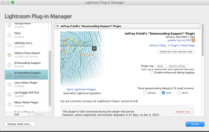
The Friedl plugin enabled.
You can vary what is disclosed in LR from this pane.
Reboot LR for the changes to take effect.
Now download your photos from your digital camera to LR, highlight the ones you want to geotag, and go to File->Plug-in Extras->Geoencode, pointing to the GPS Tracks GPX file on your desktop thus:
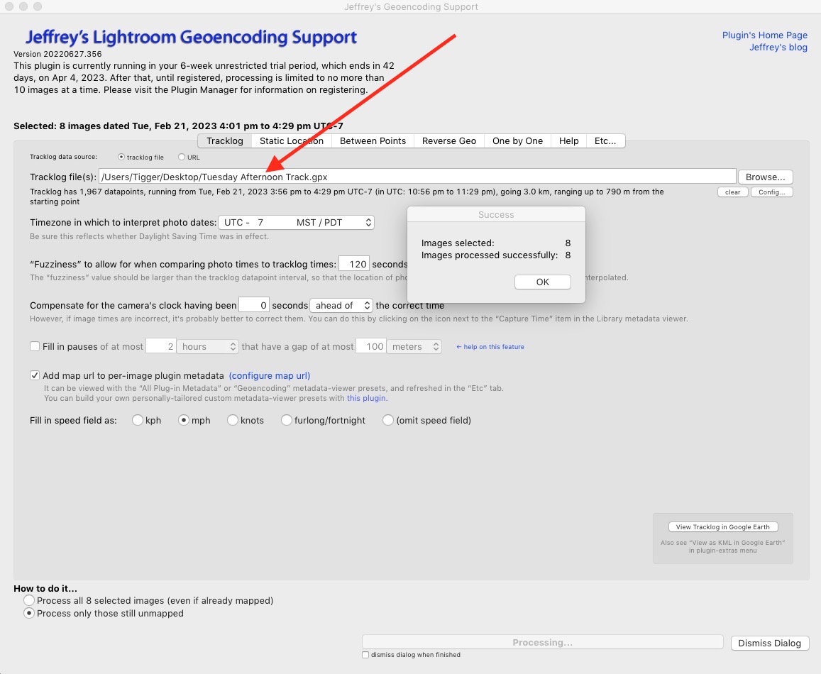
The Friedl plugin after geotagging 8 images.
Your images are now geotagged and you can display them in Google Earth using Lightroom, just like you used to be able to do before Adobe broke the Maps module in LR, as follows:
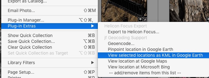
How to display your journey in Google Earth
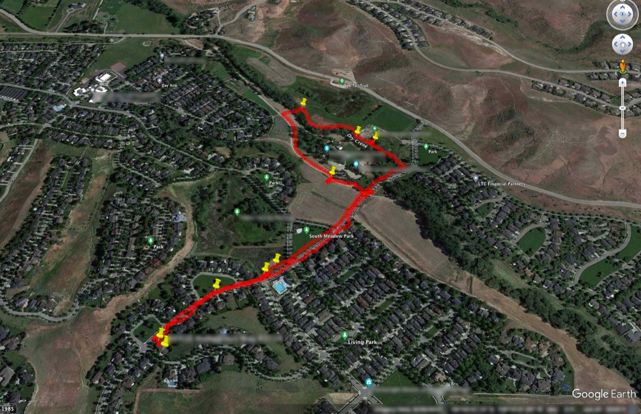
The GPS track displayed in Google Earth.
The yellow pushpins show where I took photos.
If all of this seems labor-intensive, be assured that it is not. The GPS data logging happens automatically in your iPhone and exporting that file to your desktop and importing it into Lightroom is a matter of seconds.
Advantages: The GPS location system in your iPhone is way superior to the one in that little Nikon DSLR plug in hardware dongle linked at the top of this piece and will work with any digital image with a time stamp.
Disadvantages: Additional battery drain on your iPhone. My 40 minute walk, above, incrementally drained some 6% of the iPhone Pro Max’s battery – call it 9% for every hour of use. Not a lot and if you have an iPhone Pro or Pro Max with the larger battery you are set for a day’s photography with GPS Tracks running all the time. If you need a recharge on the go consider one of those inexpensive pocketable car starter batteries.